View Photo Gallery
After graduating from HP University in May of 1984 all I could think of was a way to pickup where I had left the trail six months ago. My intentions were to do a longer section of the AT to test myself. So I chose to hike the remainder of the southern section down to Springer Mt. GA. - about 400 miles.
My friend Ernie Hiatt was in graduate school at Clemson, and he said he could pick me up Amicalola Falls State Park when I finished as it was somewhat close to Clemson. From there I could ride the train back to Greensboro.
On May 14 1984 my family drove me and my brother Kent to Highway 19E close to Roan Mt City where the trail crossed the highway, and we began our trip.
It seems all trips begin with unbridled excitement of the adventure to come, unitil you put the overweight pack on and start hiking up hill. In our case it was about a 5 mile and 2700 foot climb to the top of Hump Mountain. I had been hiking and camping on Roan Mt. many times before but never on this section before. When we reached the top of Hump Mt. I could not believe the beautiful expanse of the "balds" in front of me. It was amazing and breath taking. I could see for miles including Roan Mt, Grandfather Mt. as well as Mt. Mitchell. To this day, this section from Highway 19E to Carvers Gap, is still one of the most beautiful sections on the AT.
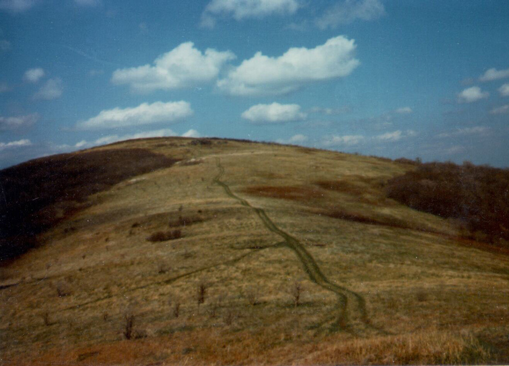
Hump Mt.
So for the next four days we hiked over the "balds" of Roan Highlands over to Unaka Mt., over Beauty Spot and down to the Nolichucky River near. Erwin TN. There we hitch hiked into town and got a motel and attacked the lunch buffet at the Pizza Hut.
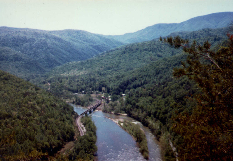
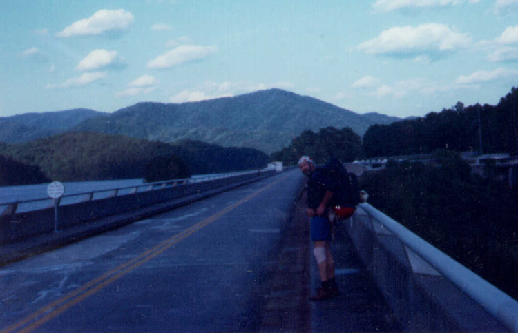
Nolichucky River
The next three days we climbed over Big Bald, crossed Sam's Gap at US 23, I-26 and arrived at Devils Fork Gap at NC 212. There my mother met us and picked Kent up. I continued on alone to Hot Springs NC 65 miles away.
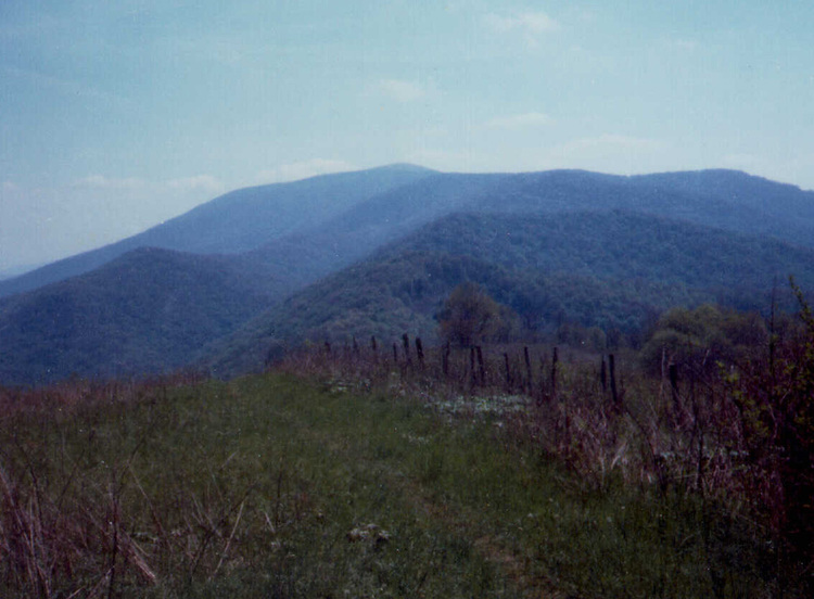
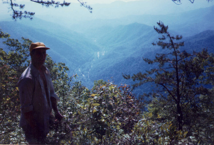
Big Bald In Distance
The next day I hiked pass Jerry Cablin Sheter, White Rock Cliffs and stayed at Laurel Sheter. The next day, Tuesday May 22, I pushed into Hot Springs NC after a 25 mile day. Hot Springs is a cool trail town beside the French Broad River. The trail runs right down main street and is considered one of the friendlest trail towns on the entire AT. I had a package at the post office I needed to pickup so I wanted to get it and get out of town the next day. Unfortunatly, my package did not arrive until Friday, so I spent these days, resting, eating and washing clothes. I worked for my stay at the Catholic Hostel those days to save money, only paying three dollars for three nights of stay!
AFter a few days I made it into the Great Smoky National Park staying at Davenport Gap Shelter. After climbing to the ridge from the shelter the trees change to Spruce and Fir with more view. I stayed at Tri-Corner Knob Shelter the next night after a long day of rain, then Icewater Shelter.
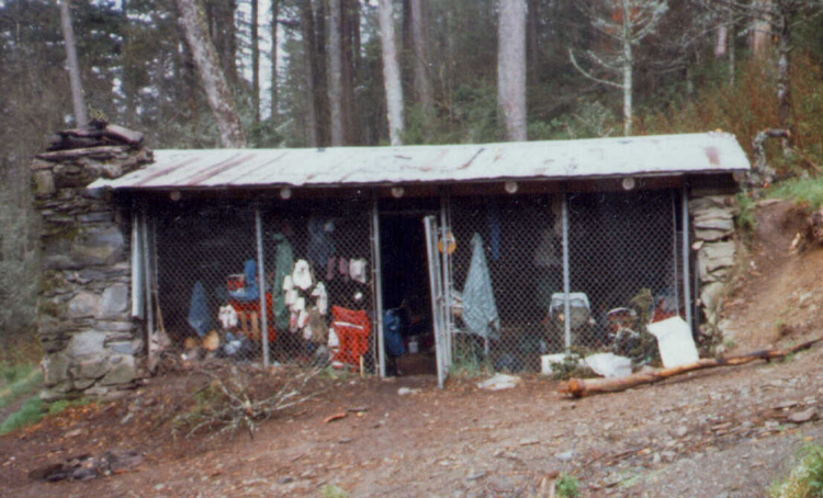
Tri-Corner Knob Shelter
On Tuesday May 29th, day 16, I hiked to Newfound Gap where I met my Dad who hiked with me 70 miles until Wesser NC. That day we hiked to Double Spring Gap Shelter. The day had turned windy and cold and hikers had a warm fire going when we arrived at 7pm. The next day we hiked over Rocky Top Mountain and camped at Russell Field Shelter. That day was a solar eclipse and the daylight was very low and erie. That day we saw deer, bear, wild boar and grouse. The next day we hiked down to Fontana Lake Dam and stayed at the Fontana Lake Shelter. They had free showers at the dam, so we took advantage of that.
After Fontana Dam, the next day we started the 30 miles to Wesser NC where the trail crossed the Nantahala River. This was a ruggled section and we were running low on food but after two days we made it through Stecoah Gap and over Cheoah Bald and hiked down 3300 feet in 8 miles to Wesser NC. My Dad's friends had come up to paddle the river and he road back to Greensboro with them. I stayed two nights at the hostel and resupplied for the final 135 miles to Springer Mt.
The next day I climbed 3000 feet out of the steep Nantahala River gorge with a very heavy pack. There were rhododendron, mountain laural and azalea blooming, the colors were beautiful. Over the next few days the weather was good and enjoyed the views from Wayah Bald, climbing the firetower at Albert Mountain. Standing Indian Mountain had great views and was one of the nicest areas to hike. Crossed into Georgia and climbed Tray Mountain, passed through Unicoi Gap and made Neels Gap on June 11th. Spent the night and resuppied for the final push to Springer. Then next day climbed up Blood Mt. GA and spend the night on the big bolder in front of the shelter. It was too hot and humid to stay in the sheler. Next two days had afternoon thundershows, one I got caught on a ridge while in a lighning storm, very scary, the other I got to a shelter just in time.
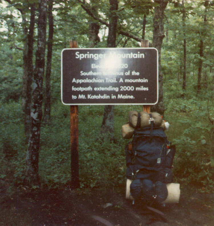
On June 14th, 6:25PM I made it to Springer Mt GA - the southern terminas of the AT. Took a few photos and then went a few miles and camped. I was off early and made the final 7 miles to Amicaloa Falls State Park where my friend Ernie picked me up. After a day in Clemson SC, I took the train to Greensboro NC arriving at 4AM.
Some hiker said your first long distance hike is like your first kiss, you will never forget it. Well, he was definitely right about that! It's something that will change you and get into your blood. The freedom you feel and the adventure you have everyday will give you a high you will never come down from.